梁欣廉
Professor
Supervisor of Doctorate Candidates
Supervisor of Master's Candidates
Date of Birth:1980-03-09
E-Mail:xinlian_liang@hotmail.com
Date of Employment:2021-01-01
School/Department:State Key Laboratory of Information Engineering in Surveying, Mapping and Remote Sensing
Education Level:With Certificate of Graduation for Doctorate Study
Business Address:State Key Laboratory of Information Engineering in Surveying, Mapping and Remote Sensing
Gender:Male
Contact Information:xinlian_liang@hotmail.com
Status:Employed
Alma Mater:Aalto University
Hits:
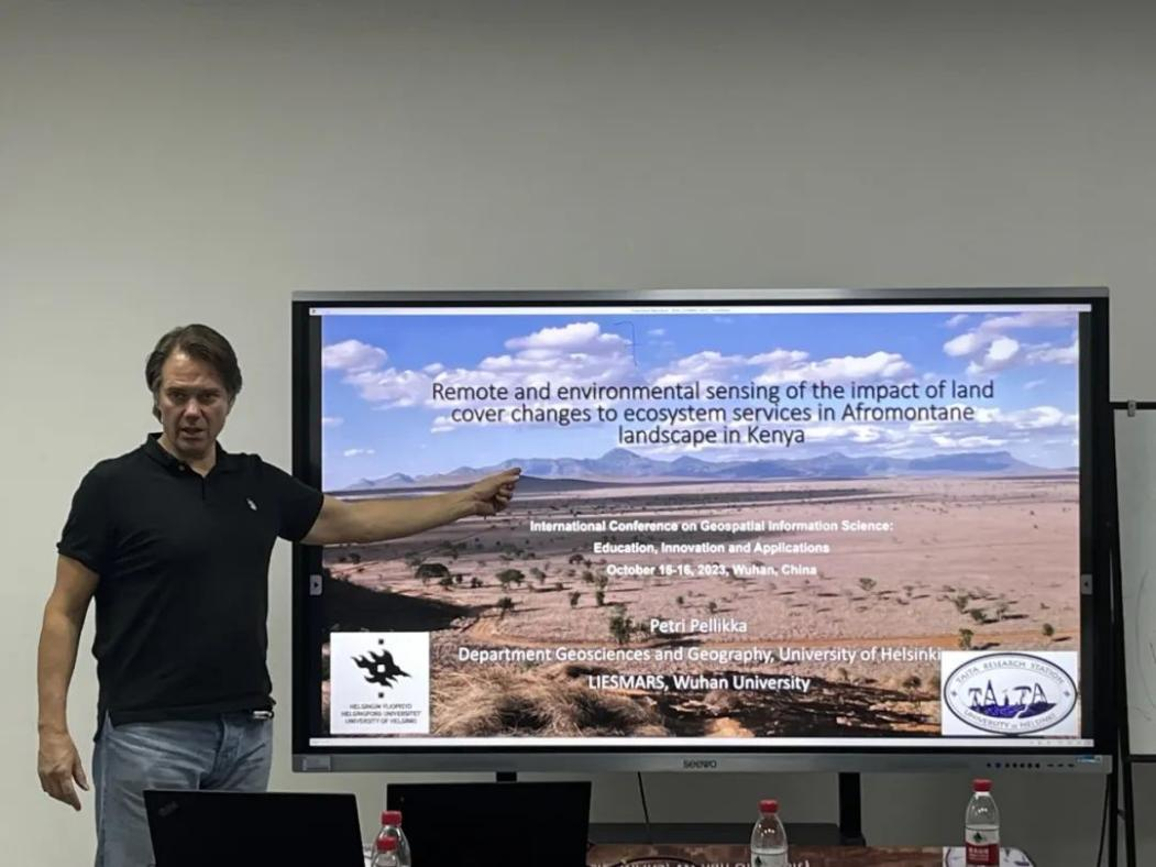
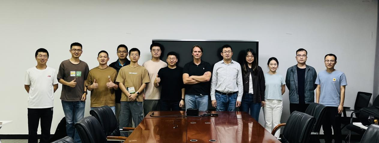
Prof. Petri Pellikka from University of Helsinki visit the MSpace team On October 13, 2023. The visit aims to explore the cutting-edge academic research topics, promote the international academic exchange, and deepen the future collaboration.
Prof. Xinlian Liang first presented an overview of the recent development in the MSpace, including system development, dataset construction, benchmarking studies, and algorithms.

Prof. Petri Pellikka delivered a presentation about the persisted research of his team, i.e., Remote and Environmental Sensing of the impact of Land Cover Changes to Ecosystem Services in Afromontane Landscape in Kenya.

The MSpace team members and Prof. Petri Pellika had an in-depth discussions on the environment observations and their applications in different geological regions.

Biography

Prof. Petri Pellikka received his Master Degree at University of Helsinki, and Ph.D Degree at University of Munich. He became the professor of Department of Geosciences and Geography, University of Helsinki, Finland in 2002, the member of the Finnish Academy of Science and Letters in 2010. He is the director of multidisciplinary Taita Research Station of the University of Helsinki in Kenya, visiting professor periods in Carleton University, Ghent University, Cambridge University, Lund University, Beijing Normal University, Wuhan University and Canterbury University. His study focuses on exploring the climate and ecosystem impacts caused by land use change for decades. His research of the land use change and its impacts to ecosystem services based on remote and environmental sensing in Africa has been persisted for more than 20 years. He has supervised 34 PhD theses.
The abstract of the presentation
Human population of sub-Saharan Africa grows the fastest in the world. Hence, the rapid expansion of cropland was required to maintain the food security. However, the land use change from forests and bushlands to agricultural fields may enhance the consequences on ecosystem services of climate change.
Land use change from natural land covers to managed systems caused vegetation and canopy cover decrease. It led to series of chain reactions. For example, carbon stocks decrease, weakening of capturing the atmospheric water by vegetation, water infiltration and evapotranspiration decrease of soil, increase of land surface temperatures and albedo. All these consequences enhanced the climate change, warming, and lack of water. However, these trends are very typical not only in the Taita Hills, but all around the sub-Saharan Africa. Hence, mitigating the climate change and proposing the smart climate smart solutions, such as agroforestry, are needed for landscapes and agricultural practices.
In mountainous Taita Hills in Kenya, CO2 sequestration and carbon stocks, water resources and greenhouse gas emissions from soils caused by land use change were monitored using remote and environmental sensing. The data utilized included satellite and airborne imagery and airborne laser scanning data, spectroscopy, and data from the field experiments on the ground. The research achievements of the land use change in Taita research station have impact other research in other parts of the world, especially in the tropical and subtropical areas.
Prof. Dr. Xinlian Liang received the Doctor degrees with honors in Geoinformatics from Aalto University, Espoo, Finland, in 2013. In 2016, he received a title of Docent at the University of Helsinki, Helsinki, Finland. He joined the Wuhan University in 2021. Previously, he was a research manager in the Finnish Geospatial Research Institute (FGI).
Dr. Liang's main research interest lies in the quantitatively understanding forest 3D structures, characteristics, and their roles in nature such as the carbon and nutrient fluxes, the energy and water cycles, as well as the biodiversity and climate changes. In past twenty years, he had collected rich experiences on forest digitization with a wide spectrum of technologies including the laser scanning, optical images, as well as multi- and hyper-spectral sensors, from terrestrial, mobile, UAV, aerial, and satellite perspectives.
His references in science are represented by a series of highly citied papers, e.g., ESI hot/highly cited paper (0.1% top cited paper in Geosciences, in ISPRS Journal 2016, first author; 1% top cited paper in Geosciences, in ISPRS Journal 2018, first author), Google scholar matrix paper (in IEEE TGRS 2012, first author), and most downloaded paper (in IEEE TGRS 2015, first author). He has an H-index 32 (ISI) and 40 (Google Scholar). Dr. Liang's publication list includes over 100 peer reviewed papers (90+ in ISI Web of Science). Since 2016, he has supervised 20+ Postdoc, PhD, and master students. Dr. Liang was listed in the World's Top 2% Scientists ranking by Stanford University in 2021 and 2022 (Top 1% in 2022).
Dr. Liang is actively involved in the international research community. He was the Chair of the Working Group III/1 'Thematic Information Extraction', the International Society for Photogrammetry and Remote Sensing (ISPRS), 2016-2022. Since 2022 he is chairing the Working Group III/1 'Remote Sensing Data Processing and Understanding'. He is the Associated Editor of Forest Ecosystems and Editor of Geo-spatial Information Science as well as Remote Sensing (all web of science listed). He is also the Guest Editor of Remote Sensing of Environment.
Personal website:https://scholar.google.com/citations?user=foWAGwYAAAAJ&hl=en&oi=ao