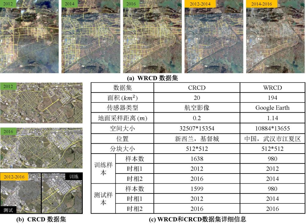
我们手动标注了两套道路变化检测与更新数据集,以评估基于多时相遥感影像的道路变化检测与更新方法的性能。第一个数据集位于新西兰基督城,命名为基督城道路变化检测 (Christchurch Road Change Detection, CRCD) 数据集。 CRCD数据集中的双时相遥感影像是下载于网站http://study.rsgis.whu.edu.cn/pages/download/building_dataset.html 的航空影像,采集时间分别为2012年和2016年。第二套数据集位于中国武汉市的江夏区,命名为武汉道路变化检测 (Wuhan Road Change Detection, WRCD) 数据集。WRCD数据集的遥感影像是从 Google Earth上下载的17级遥感影像,获取时间为 2012、2014 和 2016 年。WRCD 和 CRCD 数据集的详细介绍如下图所示。

下载链接
[Baidu Netdisk](https://pan.baidu.com/s/13OKNkuny7gVsJaeRdJCL1w?pwd=e6s0, password: 06aa
Citation
If you use our dataset, please consider citing our work:
[1] Zhou, M., Sui, H., Chen, S., Chen, X., Wang, W., Wang, J. and Liu, J., 2022. UGRoadUpd: An Unchanged-Guided Historical Road Database Updating Framework Based on Bi-Temporal Remote Sensing Images. IEEE Transactions on Intelligent Transportation Systems, 23(11), pp.21465-21477.


